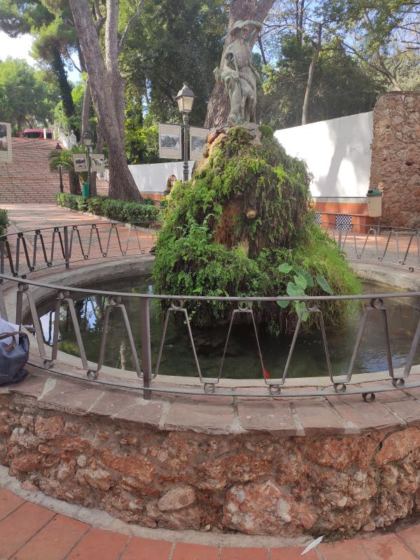
Fuente del Pastoret d'Ortells.
Class: pre-industrial element
Type: water source
Municipality: Vila-real
Basin: JÚCAR
watershed: RIO MIJARES
Accesibility
Conservation status:
Actual use:
Access:
Measures
Area
No units selected
No linear units selected
No volume units selected
No flow units selected
Coordinates
Longitude: -0.11656350895271732
Latitude: 39.96156774617953
Projected UTM zone: 30
SRID code: 25830
Projected UTM (x): 746285.6
Projected UTM (y): 4427473.8
Date
Type of date: year
Year: 1920
The 5 closest
Pozo ornamental de la Virgen de Gracia (water well): 72 m
Área recreativa El Termet (recreation area): 89 m
Moli fariner de l’Ermita o Pedro Benedito (watermill): 131 m
Piscina municipal el Termet (swamp): 150 m
Azud del molino de Bisbal (weir): 167 m
The 5 closest water source
Fuente de agua potable : 7.24 km
Sec River Channel : 11.52 km
Fuente de los criados del Pantano de Tibi : 215.972 km
Fonte das negras : 785.437 km
Fonte do Jardim : 785.864 km
Fuente del Pastoret d'Ortells.
2021-10-21 jose
Description
Map
Web links
Media
Slideshow

Videos
Not video found
Sounds
Not audio file found
water source class specific data
Ponds
# ponds: No defined