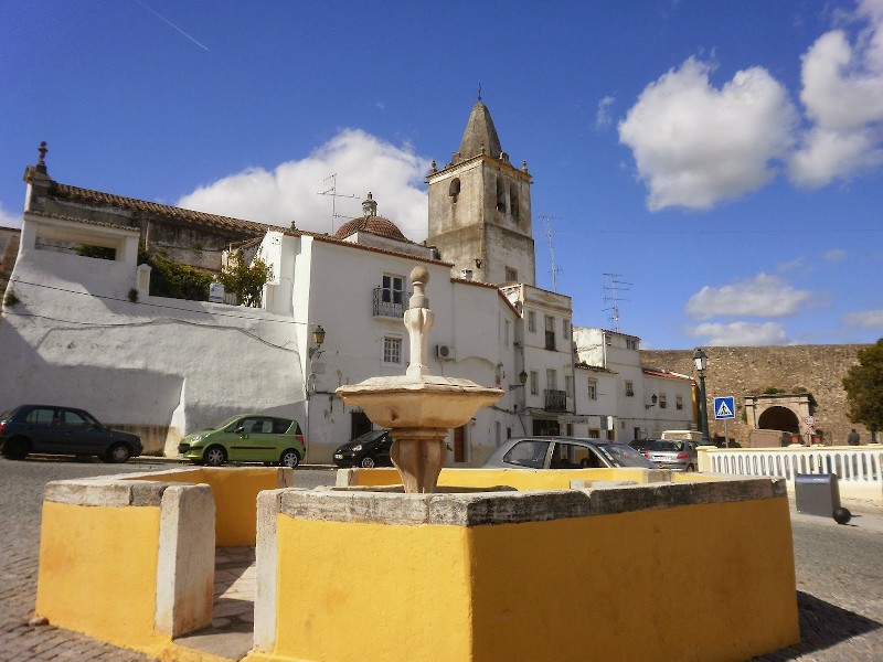
Fonte de São Vicente
Class: pre-industrial element
Type: water source
Municipality: Caia, São Pedro e Alcáçova
Basin:
watershed: not found
Accesibility
Conservation status: good
Actual use: disuses
Access: walking
Measures
Area
Units: square meters
Area: without area
Linear
Units: meters
Length: 3
Width: 3
Height: 3
No volume units selected
No flow units selected
Coordinates
Longitude: -7.160430550575257
Latitude: 38.88190101283019
Projected UTM zone: 29
SRID code: 25829
Projected UTM (x): 659561.9
Projected UTM (y): 4305279.3
Date
Type of date: year
Year: 1628
The 5 closest
Fonte da Prata (water source): 247 m
Fonte de São Lourenço (water source): 316 m
Poço de Alcalá (water well): 349 m
Fonte da Misericórdia (water source): 761 m
Fonte da Biquinha (water source): 797 m
The 5 closest water source
Fonte da Prata : 247 m
Fonte de São Lourenço : 316 m
Fonte da Misericórdia : 761 m
Fonte da Biquinha : 797 m
Fonte da Alameda : 886 m
Fonte de São Vicente
2023-06-12 null
Description
Map
Web links
#1 : https://www.visitarportugal.pt/portalegre/elvas/elvas/fonte-sao-vicente
#2 : Not defined
Media
Slideshow

Videos
Not video found
Sounds
Not audio file found
water source class specific data
Ponds
# ponds: 1