.jpg)
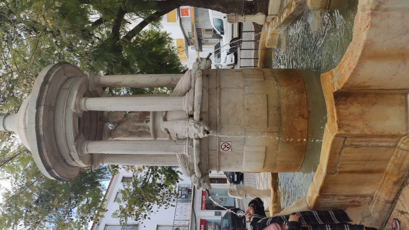
Fonte da Misericórdia
Class: pre-industrial element
Type: water source
Municipality: Assunção, Ajuda, Salvador e Santo Ildefonso
Basin:
watershed: not found
Accesibility
Conservation status:
Actual use:
Access:
Measures
Area
Units: square meters
Area: without area
Linear
Units: meters
Length: without length
Width: 5
Height: 4
Volume
Units: liters
Length: without volume
Flow
Units: liters/minute
Length: without volume
Coordinates
Longitude: -7.166058300805448
Latitude: 38.87888277537293
Projected UTM zone: 29
SRID code: 25829
Projected UTM (x): 659080.4
Projected UTM (y): 4304934.5
Date
Type of date: year
Year: 1622
The 5 closest
Fonte da Biquinha (water source): 113 m
Fonte da Alameda (water source): 132 m
Cisterna (reservoir): 186 m
Chafariz do Aqueduto (water source): 393 m
Fonte de São Lourenço (water source): 469 m
The 5 closest water source
Fonte da Biquinha : 113 m
Fonte da Alameda : 132 m
Chafariz do Aqueduto : 393 m
Fonte de São Lourenço : 469 m
Fonte de São Vicente : 761 m
Fonte da Misericórdia
2023-06-12 jose
Description
Map
Web links
#1 : Not defined
#2 : Not defined
Media
Slideshow
.jpg)

Videos
Not video found
Sounds
Not audio file found
water source class specific data
Ponds
# ponds: 1