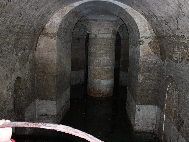
Cisterna do Forte da Nossa Senhora da Graça
Class: civil element
Type: reservoir
Municipality: Caia, São Pedro e Alcáçova
Basin:
watershed: not found
Accesibility
Conservation status:
Actual use: disuses
Access: walking
Measures
Area
No units selected
No linear units selected
No volume units selected
No flow units selected
Coordinates
Longitude: -7.164277960438858
Latitude: 38.894844400567244
Projected UTM zone: 29
SRID code: 25829
Projected UTM (x): 659199.2
Projected UTM (y): 4306709.1
Date
Type of date: century
Century: XVIII
The 5 closest
Fonte da Prata (water source): 1.687 km
Poço de Alcalá (water well): 1.784 km
Fonte de São Vicente (water source): 1.9 km
Fonte de Gil Vaz (water source): 2.049 km
Fonte de São Lourenço (water source): 2.113 km
Cisterna do Forte da Nossa Senhora da Graça
2023-06-12 null
Description
Map
Web links
#1 : Not defined
#2 : Not defined
Media
Slideshow

Videos
Not video found
Sounds
Not audio file found