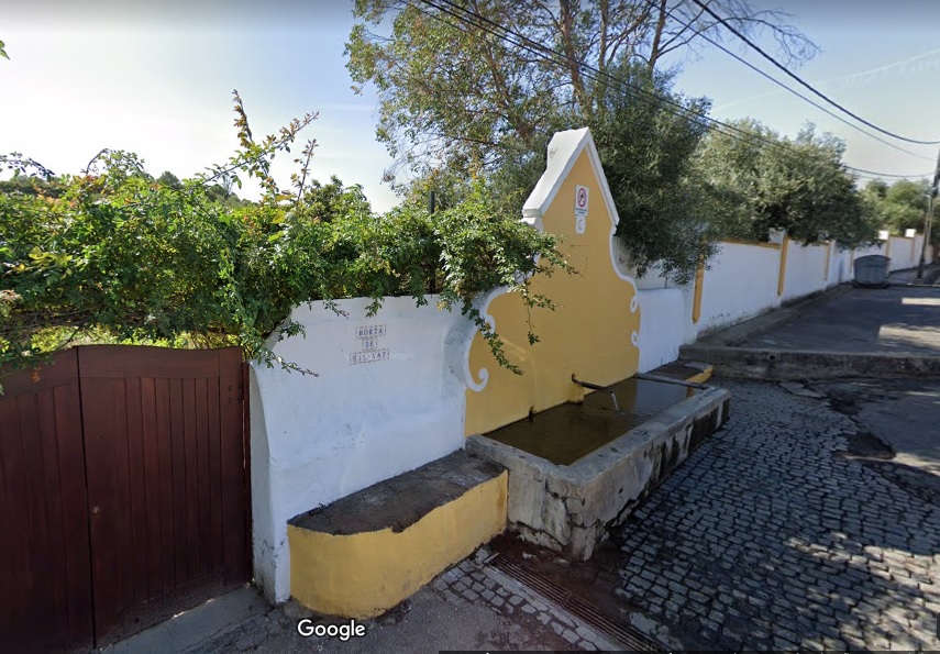
Fonte de Gil Vaz
Class: pre-industrial element
Type: water source
Municipality: Caia, São Pedro e Alcáçova
Basin:
watershed: not found
Accesibility
Conservation status:
Actual use:
Access:
Measures
Area
No units selected
No linear units selected
No volume units selected
No flow units selected
Coordinates
Longitude: -7.1485376358032235
Latitude: 38.887419231196475
Projected UTM zone: 29
SRID code: 25829
Projected UTM (x): 660581.1
Projected UTM (y): 4305912.6
Date
Type of date:
The 5 closest
Fonte da Prata (water source): 1.374 km
Fonte de São Vicente (water source): 1.541 km
Poço de Alcalá (water well): 1.815 km
Fonte de São Lourenço (water source): 1.839 km
Cisterna do Forte da Nossa Senhora da Graça (reservoir): 2.049 km
The 5 closest water source
Fonte da Prata : 1.374 km
Fonte de São Vicente : 1.541 km
Fonte de São Lourenço : 1.839 km
Fonte da Misericórdia : 2.301 km
Fonte da Biquinha : 2.337 km
Fonte de Gil Vaz
2023-05-24 null
Description
Map
Web links
#1 : Not defined
#2 : Not defined
Media
Slideshow

Videos
Not video found
Sounds
Not audio file found
water source class specific data
Ponds
# ponds: 1