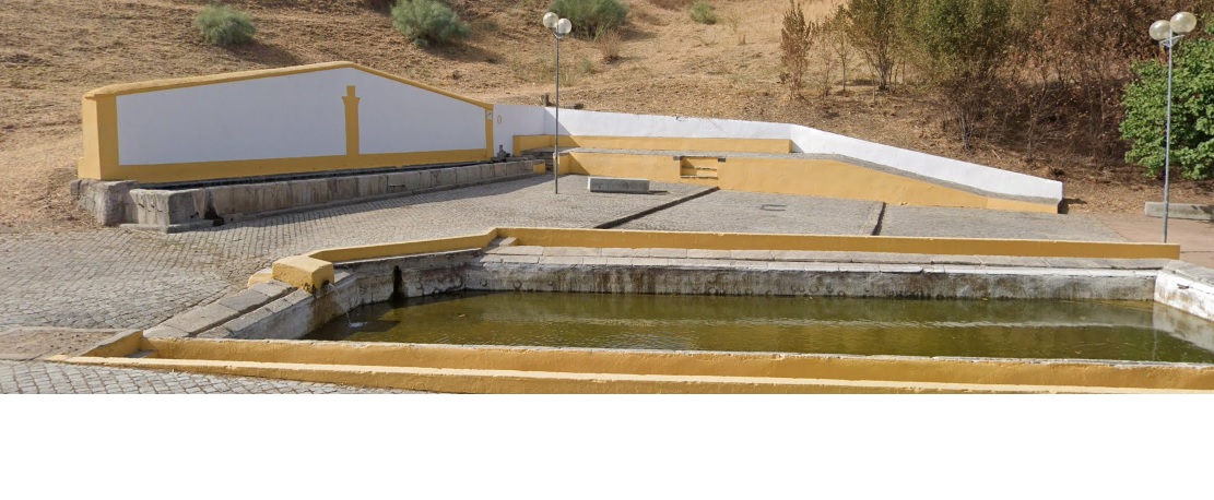
Fonte da Prata
Class: pre-industrial element
Type: water source
Municipality: Caia, São Pedro e Alcáçova
Basin:
watershed: not found
Accesibility
Conservation status:
Actual use:
Access:
Measures
Area
No units selected
No linear units selected
No volume units selected
No flow units selected
Coordinates
Longitude: -7.15984046459198
Latitude: 38.88356508370861
Projected UTM zone: 29
SRID code: 25829
Projected UTM (x): 659609.3
Projected UTM (y): 4305465.1
Date
Type of date:
The 5 closest
Fonte de São Vicente (water source): 247 m
Poço de Alcalá (water well): 441 m
Fonte de São Lourenço (water source): 552 m
Fonte da Misericórdia (water source): 963 m
Fonte da Biquinha (water source): 980 m
The 5 closest water source
Fonte de São Vicente : 247 m
Fonte de São Lourenço : 552 m
Fonte da Misericórdia : 963 m
Fonte da Biquinha : 980 m
Fonte da Alameda : 1.093 km
Fonte da Prata
2023-05-24 jose
Description
Map
Web links
#1 : Not defined
#2 : Not defined
Media
Slideshow

Videos
Not video found
Sounds
Not audio file found
water source class specific data
Ponds
# ponds: 1