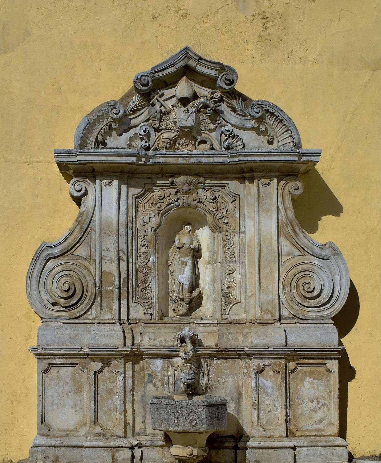
Fonte da Biquinha
Class: pre-industrial element
Type: water source
Municipality: Assunção, Ajuda, Salvador e Santo Ildefonso
Basin:
watershed: not found
Accesibility
Conservation status: good
Actual use: in use
Access: car
Measures
Area
No units selected
No linear units selected
No volume units selected
No flow units selected
Coordinates
Longitude: -7.166830301284791
Latitude: 38.87939809963618
Projected UTM zone: 29
SRID code: 25829
Projected UTM (x): 659012.3
Projected UTM (y): 4304990.4
Date
Type of date:
The 5 closest
Cisterna (reservoir): 73 m
Fonte da Misericórdia (water source): 113 m
Fonte da Alameda (water source): 182 m
Chafariz do Aqueduto (water source): 319 m
Fonte de São Lourenço (water source): 530 m
The 5 closest water source
Fonte da Misericórdia : 113 m
Fonte da Alameda : 182 m
Chafariz do Aqueduto : 319 m
Fonte de São Lourenço : 530 m
Fonte de São Vicente : 797 m
Fonte da Biquinha
2023-05-24 jose
Description
Map
Web links
#1 : Not defined
#2 : Not defined
Media
Slideshow

Videos
Not video found
Sounds
Not audio file found
water source class specific data
Ponds
# ponds: 1