Cisterna
Class: civil element
Type: reservoir
Municipality: Assunção, Ajuda, Salvador e Santo Ildefonso
Basin:
watershed: not found
Accesibility
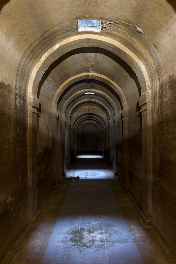
Conservation status: good
Actual use: disuses
Access: walking
Measures
Area
Units: square meters
Area: without area
Linear
Units: meters
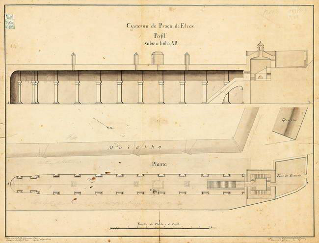
Length: 58
Width: 5
Height: 8
Volume
Units: cubic meters
Length: 2320
No flow units selected
Coordinates
Longitude: -7.167382211394186
Latitude: 38.87967956377653
Projected UTM zone: 29
SRID code: 25829
Projected UTM (x): 658963.8
Projected UTM (y): 4305020.7
Date
Type of date:
The 5 closest
Fonte da Biquinha (water source): 73 m
Fonte da Misericórdia (water source): 186 m
Fonte da Alameda (water source): 233 m
Chafariz do Aqueduto (water source): 277 m
Poço de Alcalá (water well): 580 m
The 5 closest reservoir
Cisterna do Forte da Nossa Senhora da Graça : 2.196 km
Embalse de Beniarrés : 757.76 km
Cisterna
2023-05-24 null
Description
Map
Web links
#1 : Not defined
#2 : Not defined
Media
Slideshow

Videos
Not video found
Sounds
Not audio file found