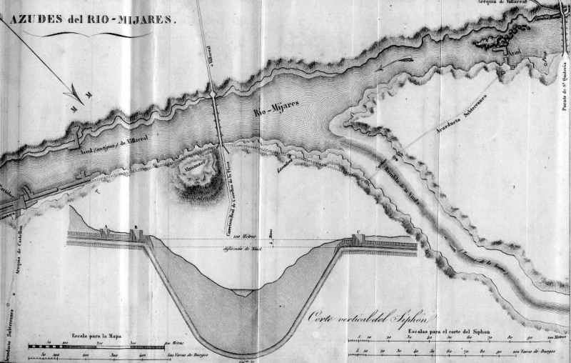
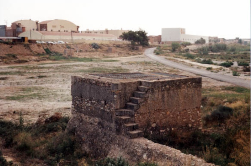
Rambla de la Viuda Ditch
Class: pre-industrial element
Type: canal
Municipality: Almazora
Basin: JÚCAR
watershed: RIO MIJARES
Accesibility
Conservation status:
Actual use:
Access:
Measures
Area
No units selected
No linear units selected
No volume units selected
No flow units selected
Coordinates
Longitude: -0.08689198115471714
Latitude: 39.9553235132325
Projected UTM zone: 30
SRID code: 25830
Projected UTM (x): 748843
Projected UTM (y): 4426863
Date
Type of date: start/end build date
Start: 1600
End: 1700
The 5 closest
Castelló/Almassora New Weir (weir): 392 m
Castelló/Almassora Weir (weir): 443 m
Puente de Santa Quiteira (bridge): 922 m
Santa Quitèria Swamp (swamp): 1.043 km
Moros Booths (weir): 1.251 km
The 5 closest canal
Mined Ditch of Castelló : 1.643 km
Ditch of the Pantà : 4.344 km
Foment Ditch : 5.728 km
Major de Castelló Ditch : 7.055 km
Mercader Ditch : 10.028 km
Rambla de la Viuda Ditch
2023-05-09 jose
Description
Map
Web links
#1 : Not defined
#2 : Not defined
Media
Slideshow

Videos
Not video found
Sounds
Not audio file found