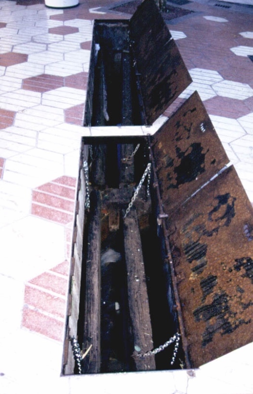
Major/Coscollosa Partitioner
Class: pre-industrial element
Type: partition
Municipality: Castellón de la Plana / Castelló de la Plana
Basin: JÚCAR
watershed: not found
Accesibility
Conservation status:
Actual use:
Access:
Measures
Area
No units selected
No linear units selected
No volume units selected
No flow units selected
Coordinates
Longitude: -0.03433431716745523
Latitude: 39.98841727904402
Projected UTM zone: 30
SRID code: 25830
Projected UTM (x): 753211
Projected UTM (y): 4430685
Date
Type of date: century
Century: XX
The 5 closest
Toll Mill (watermill): 38 m
Primer Mill (watermill): 633 m
Gombau Mill (watermill): 671 m
Roder Mill (watermill): 701 m
Cervera Mill (watermill): 808 m
The 5 closest partition
Mitjana Partitioner : 2.77 km
Sequiol Partitioner : 3.067 km
Partidor de llengües Almalafa/Vinamargo : 4.232 km
Almalafa/Valero Partitioner : 5.44 km
Former Royal Partitioners : 7.492 km
Major/Coscollosa Partitioner
2023-05-09 jose
Description
Map
Web links
#1 : Not defined
#2 : Not defined
Media
Slideshow

Videos
Not video found
Sounds
Not audio file found