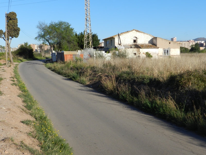
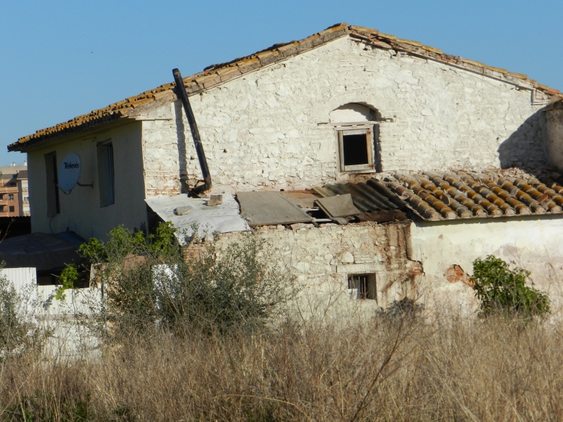
Ortells Mill
Class: pre-industrial element
Type: watermill
Municipality: Castellón de la Plana / Castelló de la Plana
Basin: JÚCAR
watershed: not found
Accesibility
Conservation status:
Actual use:
Access:
Measures
Area
No units selected
No linear units selected
No volume units selected
No flow units selected
Coordinates
Longitude: -0.02542780313105593
Latitude: 39.97373149649021
Projected UTM zone: 30
SRID code: 25830
Projected UTM (x): 754026
Projected UTM (y): 4429080
Date
Type of date: century
Century: XIX
The 5 closest
Major de Castelló Ditch (canal): 517 m
Cerdà Mill (watermill): 829 m
Olzina Mill (watermill): 879 m
Soterrani Mill (watermill): 1.671 km
Gombau Mill (watermill): 1.682 km
The 5 closest watermill
Cerdà Mill : 829 m
Olzina Mill : 879 m
Soterrani Mill : 1.671 km
Gombau Mill : 1.682 km
Roder Mill : 1.825 km
Ortells Mill
2023-05-09 jose
Description
Map
Web links
#1 : Not defined
#2 : Not defined
Media
Slideshow

Videos
Not video found
Sounds
Not audio file found
watermill class specific data
Roof
Roof material: No defined
Stairs
Stairs type: No defined
Machinery
Type: No defined
Status: No defined
Slab
Slab material: No defined