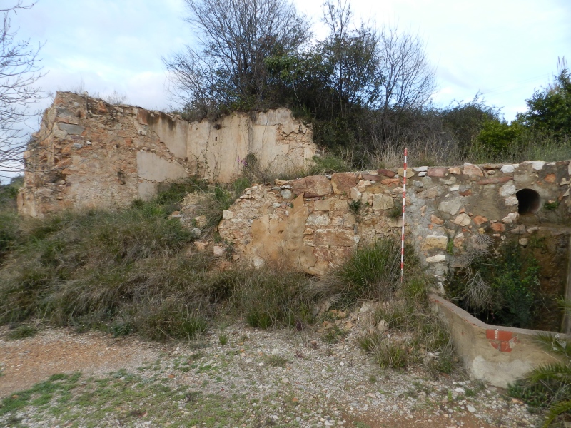
Mercader Mill
Class: pre-industrial element
Type: watermill
Municipality: Castellón de la Plana / Castelló de la Plana
Basin: JÚCAR
watershed: RIO MIJARES
Accesibility
Conservation status:
Actual use:
Access:
Measures
Area
No units selected
No linear units selected
No volume units selected
No flow units selected
Coordinates
Longitude: -0.1568973823927529
Latitude: 40.012380291503604
Projected UTM zone: 30
SRID code: 25830
Projected UTM (x): 742660
Projected UTM (y): 4433004
Date
Type of date: start/end build date
Start: 1200
End: 1700
The 5 closest
Barranc d’Almela Aqueduct (aqueduct): 1.419 km
Mercader Ditch (canal): 1.545 km
Maria Cristina Swamp (swamp): 2.435 km
Barranc del Malvestit Aqueduct (aqueduct): 2.866 km
Pou del Mas de Rambla Chimney (chimney): 4.591 km
The 5 closest watermill
Moli fariner de l’Ermita o Pedro Benedito : 8.638 km
Casalduch Mill : 13.519 km
Romeral Mill : 13.964 km
Toll Mill : 14.081 km
Primer Mill : 14.088 km
Mercader Mill
2023-05-09 jose
Description
Map
Web links
#1 : Not defined
#2 : Not defined
Media
Slideshow

Videos
Not video found
Sounds
Not audio file found
watermill class specific data
Roof
Roof material: No defined
Stairs
Stairs type: No defined
Machinery
Type: No defined
Status: No defined
Slab
Slab material: No defined