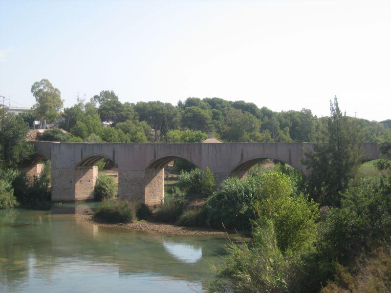
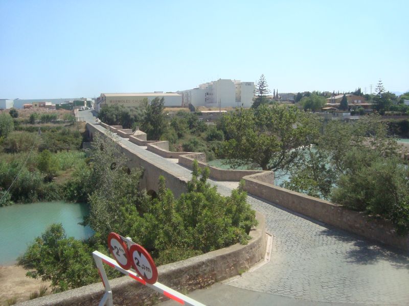
Puente de Santa Quiteira
Class: civil element
Type: bridge
Municipality: Vila-real
Basin: JÚCAR
watershed: RIO MIJARES
Accesibility
Conservation status: good
Actual use: in use
Access: walking
Measures
Area
No units selected
Linear
Units: meters
Length: 154
Width: 3
Height: 12
No volume units selected
No flow units selected
Coordinates
Longitude: -0.09499344691429903
Latitude: 39.95398900754845
Projected UTM zone: 30
SRID code: 25830
Projected UTM (x): 748155.7
Projected UTM (y): 4426692.3
Date
Type of date: century
Century: XVIII
The 5 closest
Santa Quitèria Swamp (swamp): 121 m
Castelló/Almassora Weir (weir): 481 m
Castelló/Almassora New Weir (weir): 543 m
Rambla de la Viuda Ditch (canal): 922 m
Moros Booths (weir): 1.928 km
The 5 closest bridge
Pont del Termet : 2.905 km
Pont de la Pobla del Bellestar : 78.166 km
Ponte da Ajuda : 805.691 km
Ponte ferroviario : 1299.758 km
Ponte Tasso : 1299.932 km
Puente de Santa Quiteira
2022-04-12 jose
Description
Map
Web links
#1 : https://es.wikipedia.org/wiki/Puente_de_Santa_Quiteria
#2 : Not defined
Media
Slideshow

Videos
Not video found
Sounds
Not audio file found
bridge class specific data
Bridge type
Bridge type: No defined
Material
Bridge material: No defined
Arches
# arches: 7
Pillars
# pillars: 7
Roof
Roof material: yes